THE PROJECT
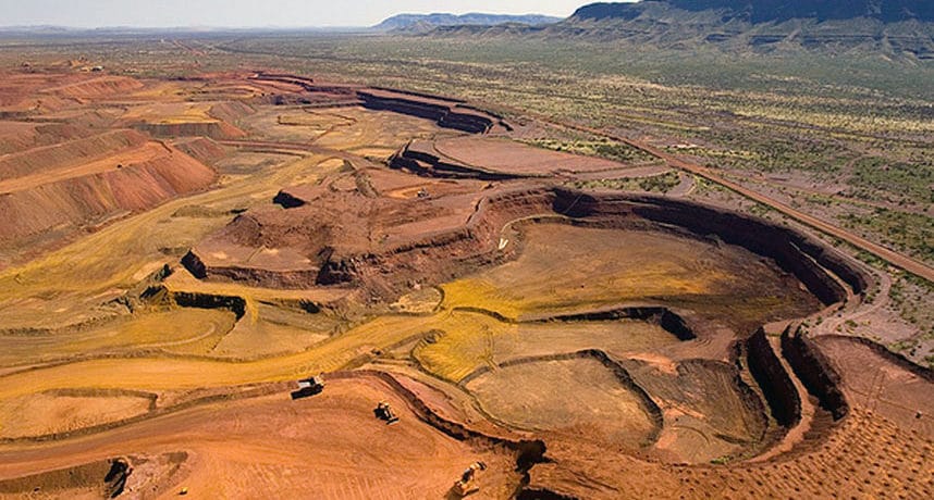
The Marandoo open-pit mine is located at the foot of Mount Bruce adjacent to the Karijini National Park, 50 km east of the town of Tom Price. The RTIO rail line skirts the northern margin of the ultimate pit.
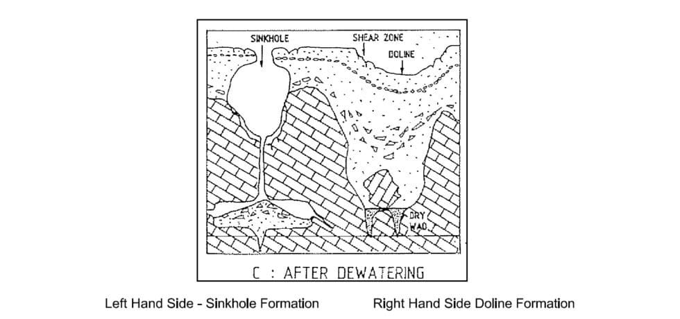
PSM was engaged to undertake the geotechnical investigation and risk assessment for potential sinkhole and doline formation. The investigation included a precedent study drilling adjacent to an existing sinkhole.
ENGINEERING AND TECHNICAL OPPORTUNITIES
The RTIO rail line is located on the northern margin of the proposed pit slope and marks the boundary of the Karijini National Park. The site geology comprises folded and faulted Archean bedrock sequences unconformably overlain by about 150 m of Cenozoic detritals including conglomerates, a thick lacustrine clay deposit and calcrete. The pre-mining water table is high, at approximately 30 m depth. The top of a thick calcrete sequence is co-incident with the pre-mining ground water level and soft to firm clay up to 100 m thick underlies the calcrete.
Engineering and technical opportunities included:
- The potential for settlement within the clay and sinkhole development in the calcrete with pit dewatering
- The weight of overburden on the clay often resulting in drill-holes being squeezed closed
- By changing the groundwater regime through dewatering for the pit development, the potential to destabilise any existing receptacles (cavities) in the calcrete system increasing the potential for sinkhole development
- Dewatering potentially resulting in doline formation due to large-scale settlement within the clay.
APPROACH AND INNOVATION
Following a rigorous assessment and modelling, PSM’s tailored approach included:
- Provision of a precedent study by drilling adjacent to an existing sinkhole
- Drilling of the clay unit with a CPT rig to more accurately profile the strength and engineering properties, a precedent for Pilbara mining
- Collection of undisturbed U50 tube samples in the clay for laboratory testing
- Coring adjacent to an existing sinkhole, a precedent for Pilbara mining, to allow investigation of geology where a sinkhole had formed for comparison with the site geology to assess the potential for and risk related to a sinkhole forming at the site
- 3D modelling of detrital units, separating materials into specific geotechnical units and using both cored and non-cored data through geochemical assessment to build a robust geological model
- Use of event trees to assess the risk to the site for sinkhole and doline formation associated with dewatering.
OUTCOMES
Two components of the field investigation were precedents for mining in the Pilbara. By using advances in drilling often employed in the civil industry, PSM successfully demonstrated a significantly improved understanding into the engineering properties of the geology than previously achieved. The sinkhole drilling study allowed an existing structure to be characterised and mechanisms of failure identified. By comparing the findings of the sinkhole study with site data, PSM identified low, moderate and high risk areas and made recommendations to monitor and mitigate that risk.
Services: #Geotechnical #goldmine #macraes #mine #oceanagold #openpit #otago #southisland #underground


